Current Weather
Clear sky, pressure steady
| Temperature | 16.9 | °C |
| Pressure | 1018 | mb |
| Humidity | 68 | %RH |
| Rainfall | 0.0 | mm |
| Wind Speed | 3 | mph |
| Wind Direction | NNE | |
Today's Events
| 05:15 | Sunrise |
| 05:48 | High tide |
| 08:31 | Moonset |
| 12:27 | Low tide |
| 18:22 | High tide |
| 21:08 | Sunset |
| 21:56 | Moonrise |


Time and Date
| Local time | 21:23 hrs |
| Time zone | BST+0100 |
| Day | Saturday |
| Date | 1st Aug 2026 |
Current Air Quality
Air quality overall is very good, with low particulate and low gaseous pollution levels
| PM10 | Very good |
| PM2.5 | Very good |
| PM1 | Very good |
| Reducing | Good |
| Oxidising | Very good |
| NH₃ | Very good |

Tick Tock, Drip Drop
Short-Term Weather Forecast
| 20:00 |  | 15.6°C | Moderate breeze, 13mph WSW | |
| 21:00 |  | 14.8°C | Gentle breeze, 11mph W | |
| 22:00 | | 14.1°C | Gentle breeze, 10mph W | |
| 23:00 |  | 13.4°C | Gentle breeze, 9mph W | |
| 00:00 | | 12.6°C | Gentle breeze, 8mph WSW | |
| 01:00 | | 11.9°C | Gentle breeze, 8mph WSW | |
| 02:00 | | 11.3°C | Gentle breeze, 8mph W |
Malmanac Weathervane Street Location

|
Seasons and Notable Days
| Vernal equinox | 20 Mar 2026 | 14:45 | End of Winter |
| Clocks change | 29 Mar 2026 | 01:00 | One hour forward |
| Summer solstice | 21 Jun 2026 | 09:24 | Midsummer |
| Midsummer day | 24 Jun 2026 | — | — |
| Autumnal equinox | 23 Sep 2026 | 01:05 | End Summer |
| Clocks change | 25 Oct 2026 | 02:00 | One hour back |
| Winter solstice | 21 Dec 2026 | 20:49 | Midwinter |
Lower Ouseburn Valley Environmental Alerts 1/2
| Barometric air pressure is steady | ||
 | Air pollution is low (index 2) | |
| It is not raining currently | ||
 | Air pollen level is low (all pollen species are currently low) | |
 | The UV index is low | |
| There are no weather alerts for North East England | ||
 | There are no flood alerts for the local area | |
 | Tide is going out to sea (falling) | |
 | There have been no storm outfall discharges across the Ouseburn catchment area during the current hour | |
 | There are no warnings of inundation due to catastophic dam breach at Kielder Reservoir | |
 | There are no tsunami warnings | |
 |
Earthquakes closest to Ouseburn, and more severe ones further away, in the last 30 days:
|
Lower Ouseburn Valley Environmental Alerts 2/2
 | The ten wildlife species seen most recently are black-headed gull, viper's-bugloss, citronella ants, fuzzy ants, and allies, typical crane flies, hornets, paper wasps, potter wasps, and allies; the most commonly recorded wildlife species observed in the area since 2024 are, in descending frequency, mallard, mute swan, common moorhen, carrion crow, european herring gull, asian lady beetle, common redshank, rock pigeon, grey wagtail, black-headed gull, garden snail, eurasian magpie | |
| No space aliens are expected in Ouseburn today — keep checking here, in case of any last minute visitors (tip: the best place to swat a passing alien is near the furnace arches of the former Liddle-Henzell Ouseburn glass works) | ||
 | Space weather forecast: The solar wind speed is currently at background levels, and geomagnetic activity has been quiet. We do not anticipate any significant enhancement in solar wind speed during the first forecast period, and geomagnetic activity is expected to remain quiet. A coronal mass ejection produced by an M-class solar flare yesterday afternoon is expected to arrive at Earth during the second forecast period. Upon arrival, geomagnetic activity is expected to increase to active levels on average, with isolated storm G1 intervals possible. Conditions are expected to gradually subside throughout the third forecast period. | |
 | The aurora alert level is green - low activity | |
| The Sun's transit occured at 13:12 hrs; it is currently 1° below the geographic horizon to the NW | ||
| Waning gibbous moon, 93% illuminated, moonrise at 21:56 hrs; the Moon is 4° below the geographic horizon to the E currently | ||
 | The International Space Station is either not passing overhead Ouseburn tonight, or is not visible due to lack of reflecting light | |
 | If there is a clear sky this evening , Saturn will be visiblethe Moon will be visible |
Tyne and Ouseburn Estuarine Tides

Latest Status and Key to Catchment Storm Outfalls
Catchment Storm Outfalls Previous 24 Hours
Map of Catchment Water Quality Sampling Locations

|
Catchment Water Quality Sampling Location Details
Recent Catchment Water Quality Observation Data
Geo-Location
| Elevation | 5.65 mAOD |
| Latitude | 54° 58' 23" N |
| Longitude | 1° 35' 24" W |
| NGR | NZ263643 |
Other Location Identifiers
| W3W | turkey.mouse.party |
| ONS | E00042114 |
| Ward | Byker |
| Postcode | NE6 1LZ |
Magnetic North
| Declination | Magnetic North is 1.0° west of True North, which itself is 1.2° west of Grid North |
Malmanac Local Data
Daily rainfall data are submitted to the My Tyne project (Tyne Rivers Trust). Data and images from Malmanac's weathervane, air quality sensors and webcam are published to public repositories:
- Royal Meteorological Institute of Belgium's Weather Observation Website (WOW) weather observation data (previously UK MetOffice WOW)
- Sensor.Community (formerly Luftdaten) air quality data
- Windy webcam image
More Information
The sources of the presented information are described in the credits. Web pages with related information can be found at:
- Air pollution current levels, definitions, descriptors and forecasts from DEFRA and European air quality index maps from the European Environment Agency
- Pollen forecast from the Met Office
- Daylight saving time by timeanddate.com
- Earthquakes by the British Geological Survey
- Flood warnings, reservoir flood maps, sign up for alerts, hflooding data sets, flood risk property search and flood risk map from the UK flood information service
- Storm overflows and outfalls by Northumbrian Water
- International Space Station trajectories by the European Space Agency
- Magnetic Declination and Grid Varience by the British Geological Survey, Ordnance Survey and MapTools
- River levels upstream in the Ouseburn at Crag Hall, Jesmond Dene and Gosforth, and the Tyne at Corbridge, Hexham and Ugly Dub by Shoothill and Farson Digital Water Cams
- River tides and explanations from Tide Times, Admiralty EasyTide, Tides4Fishing and the Royal Yachting Association
- Sea tides at North Shields by XTide
- Space weather and index levels from the British Geological Survey
- Tsunami warnings from CWarn
- Weather forecasts from the Norwegian Meteorological Institute and Ventusky
- Weather warnings by the Met Office.
Other Notes
The actual water level in the Ouseburn at The Malings is dependent upon many additional factors including River Tyne flowrate, Ouseburn flowrate, Ouseburn Barrage gate position and weir level, air pressure, wind-driven storm surges, silt scouring, and any storm drain surcharge. For more information see the Environment Agency's Tyne Catchment Flood Management Plan (2009)/ (2012) and Ouseburn Surface Water Management Plan (2015), and Newcastle City Council's Local Flood Risk Management Plan (2016).
Reservoirs often help reduce flooding. Gateshead City Council have also published Inundation Map (Kielder) which illustrates the largest area that might be flooded if a reservoir like Kielder Reservior were to fail and release the water it holds (explanation and more). See also online flood risk map.
About www.malmanac.uk
Live data displayed is drawn from processes which update monthly, daily, hourly or more frequently. This is The Malings Almanac (Malmanac):
- Version 1.70
- 24 Jul 2026
Malmanac was conceived during November 2017 and launched on 29 January 2018. It is published under a Creative Commons Attribution 4.0 International License and was made from a local Raspberry Pi Model 3 B with camera module (upgraded in 2022 to a Raspberry Pi Zero W with high-quality camera), an internet-hosted Apache HTTPD web server, several open data providers, a little design, and lots of software written in Python. In summer 2025, a teletext service was developed named MALTEXT, that displays a subset of data from the Malings Almanac and information about events at BottleWorks pop-up space and the nearby area. MALTEXT is periodically displayed live on a monitor in a window at BottleWorks when there is not an occupier.
Malmanac at www.malmanac.uk and the MALTEXT teletext pages are a personally-created and maintained website, and information is provided in good faith for reasonable use.
Lower Ouseburn
The Lower Ouseburn Valley Conservation Area is defined in the Character Statement and Conservation Area Management Plan. It spans both Ouseburn and Byker wards. The area has a medium-term the Regeneration Plan, and an Urban Design Framework which sets out generic design principles and general land-use planning and transportation issues for the redevelopment of the valley.
The Ouseburn Trust aims to achieve a vibrant, diverse and sustainable future for the Ouseburn Valley, delivering the objectives of the Regeneration Plan.
Three organisations particularly active with matters relating to the river, surface water run-off and flooding are:
The Malings
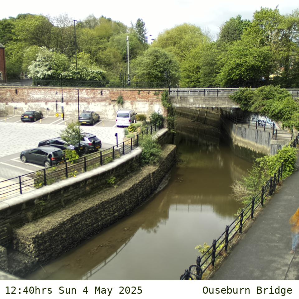
The Malings, a housing development by Carillion-Igloo, is situated on the east bank of the Lower Ouseburn (in ONS output area E00042114), between Ouseburn Bridge (Byker Bank) and Glasshouse Bridge (Walker Road) near the Tyne. It is part of Byker Ward in the City of Newcastle, located on the site of the former Malings Ford A Pottery. It is within the Lower Ouseburn Valley Conservation Area.
Homes at The Malings lie between Hume Street/Maling Street and Riverside Walk, and include the postal addresses of:
- Maling Terrace (1-10 NE6 1LZ)
- Luxor Row (1-12 NE6 1LG)
- Rosalind Place (1-10 NE6 1LJ)
- Kingfisher Place (1-16 NE6 1LT)
- Peony Place (1-9 NE6 1LU)
- Riverside Walk (1-8 NE6 1LX)
- Maling Street (14-27 NE6 1LP).
People of The Malings
The homes are inhabited by diverse people whom you can listen to at peopleofthemalings, a web project by the architects of The Malings Ash Sakula.
Contact
For any queries, comments or compliments about Malmanac, please email [email protected], or by making contact using @[email protected] on Mastodon which toots environmental, astronomical, tidal and river data throughout every day. You can also send post to Malings Almanac c/o BottleWorks, 8 Riverside Walk, Newcastle upon Tyne NE6 1LX.
Credits
Weather, air quality and astronomical data: Current local weather and air pollution conditions from the Malings Almanac's own weathervane and air quality sensors. Pollen forecast from Met Office. Short-term weather forecast and UV index from Open Meteo. International Space Station visibility data for Newcastle from Heavens Above. Weather alerts from the MetOffice. Tsunami warnings from CWarn Tsunami Early Warning System. Celestial calculations performed using the PyEphem library.
Tide times and river level data: Primary source for tide data from Tide Times for Newcastle upon Tyne based on data from the UK Hydrograph Office for Newcastle upon Tyne. Current level estimate interpolated using a formula provided by New Zealand Nautical Almanac 2017. Tyne Estuary and Ouseburn at Byker flood warnings provided by the UK Environment Agency.
Drain, pumping station and sewage treatment outfall spill data into the Ouesburn, its tributaries, Ouseburn estuary and Tyne estuary, provided near real-time unverified, by Northumbrian Water. Water quality data from records of Tyne Rivers Trust's Tyne Catchment Partnership Adopt a Steam project's periodic citizen science sampling and testing observations using Rivers Trust methodology, via the Water Ranger data platform's API.
Address data: Postcodes from Royal Mail, 3 word address from the What3Words, and walking route map self-created.
Ground level data: Ouseburn Barrage design drawings from the Newcastle Photos Blog and additional information from the Ouseburn Trust River Users Group. Flood levels from the risk assessment for The Malings development (planning application 2012/1277), by AMEC Environmental and Infrastructure UK.
Species data: animal, bird, fish, insect, plant, fungi and other data from the iNaturalist API, which predominantly includes observations in the local area as a result of Wild Intrigue's Wild Ouseburn project which spans a larger area.
Earthquake data: Records from British Geological Survey.
Space weather: Geomagnetic actrivity from British Geological Survey. Aurora alert levels from AuroraWatch UK.
Declination data: Calculated using maptools.com and bgs.ac.uk.
Clock change data: Times from gov.uk.
Icons: Moon phases and weather forecasts by Erik Flowers. Current weather icons created by Peter Schmalfeldt from Ashley Jager's designs. All other icons from the Noun Project: air pollution based on smog by Yu luck; aurora based on aurora borealis by Diheksa26; pollution by Chintuza; flooding based on flood by Arthur Shlain; uv level based on uv by Suprihatin; reservoir inundation based on dam by iconsmind.com, space weather by BomSymbols, tsunami based on tsunami by H Alberto Gongora, earthquake by abdul karim; kingfisher by Connor Fowler; Low/high tide and moonrise/moonset by Xinh Studio; pollen by Ali Khamdan; sunrise/sunset by Bryn Taylor; space station by Lucid Formation; solar system by lastspark. Noun Project icons are published under the Creative Commons Attribution License.